UK Fossil Hunting Guide for Beginners and Families
Unearth Britain’s ancient past and learn how to find your very own relics with this comprehensive UK fossil hunting...

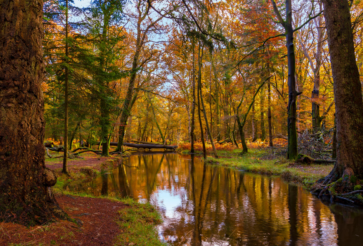


In the New Forest National Park, 566 km2 of picturesque woodlands, quaint villages, and a 40-mile coastline await. Why not enjoy this striking landscape on foot and embark on one of these stunning New Forest walks?
This array of New Forest walks showcases the best of the national park’s varied scenery, with marshes, heathland and ancient forests being a few of the featured landscapes.
Not only do these New Forest walks contain a variety of outdoor spaces to explore but most of them are easy to traverse. They’re perfect for families who want to get outdoors!
Keep reading to discover 9 of the best walking routes in the New Forest…
We’re kicking off this list of New Forest walks with the easy Wilverley Inclosure trail. This walk mainly features flat, man-made paths, making for both a pet-friendly and family-friendly walk.
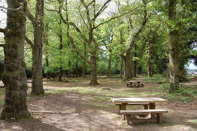
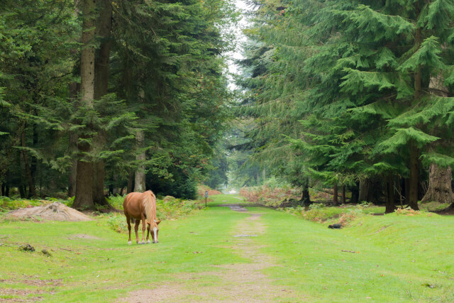
It begins at the enclosure’s ‘Scout Camp Access’ gate, pass through this and follow the gravel track; ignore any junctions along the way. A few picnic benches are lining the path, so you can enjoy a sit down amongst nature. You might even spot wildlife at this point, including ponies and deer.
You’ll soon reach a yellow/green marker, double back and head left before heading downhill. Turn right at the wooden bench and enjoy a walk through the pine trees until reaching a gate.
Venture through the gate, following the enclosure fence before passing through another gate and heading right. Soon you’ll meet a junction; choose the left-hand path and follow this until turning right at the next junction. At this point you’ll be at the start of the loop, finishing the hike!
Distance: 3.5 miles
Difficulty: Easy
Suitable for: Families and pets
Starting Point Coordinates: 50.8052625, -1.644789
Find the full route here.
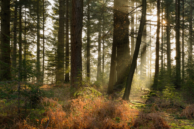
The short hike of the Tall Trees Trail enjoys a mystical feeling throughout, with charming ponies and firs making for a beautiful walk. This New Forest circular walk is ideal for the little ones, thanks to its flat paths and lack of gates.
Begin the walk at Blackwater car park, where you’ll need to pass under the oak archway and follow a rightward track. Continue straight along this track; here, you’ll come across the largest trees in the national park, such as Douglas fir and Wellingtonia.
Once you reach Brock Hill car park, venture right across the neighbouring road before following the path down towards the starting point. Afterwards, why not head next door and explore the beautiful forest of the Blackwater Arboretum?
Distance: 1.5 miles
Difficulty: Easy
Suitable for: Families and pets
Starting Point Coordinates: 50.8408695, -1.6209686
Find the full route here.
This New Forest walk takes you out of the woods and near England’s south coast. This easy-moderate walk follows flat paths whilst also passing by places of interest.
Embark on the linear walk from the car park in the centre of Beaulieu, and follow a gravel track from here onto the high street. Turn right, then left towards a narrow path before following its signage.
After passing through two gates you’ll come to a fork in the path. Don’t worry about this as either trail reconnects with the route. At this point, you’ll pass the historic site of the brickworks chimney. Keep following the path whilst keeping your eyes peeled for diamond signs pointing towards Buckler’s Hard.
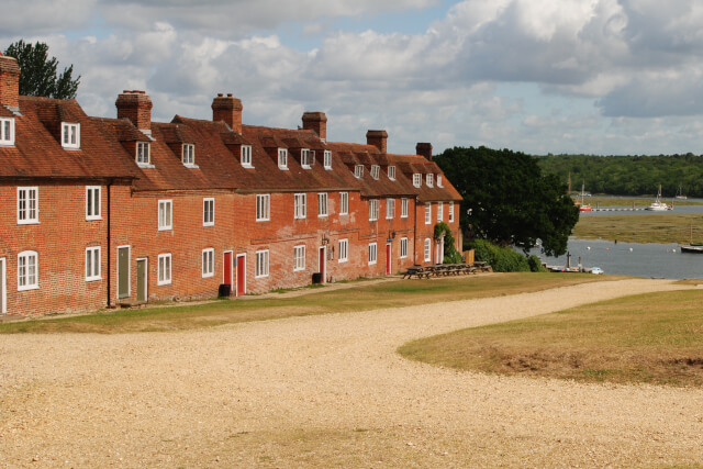
After passing two gates, you’ll start wandering along a downhill slope. Another fork in the path will appear, head right to reach Buckler’s Hard. The historic village is a wonderful ending point, featuring 18th-century architecture and a fascinating maritime museum.
Distance: 4.5 miles
Difficulty: Easy/moderate
Suitable for: Families
Starting Point Coordinates: 50.8175555, -1.4529188
Find the full route here.
Another scenic addition to this collection of walks in the New Forest, the Bolderwood Circular offers an easy trail that’s suitable for all ages. Not only is it a simple route to follow but it enjoys views of the Bolderwood Deer Sanctuary.
This walk starts at Bolderwood Car Park. From here, cross the road and wander west into Bolderwood. There will be signs for three routes in the forest at this point; choose The Radnor Trail. Follow the trail to the sanctuary, where you can pause at the viewing platform.
Leave the sanctuary and keep to the right along the downhill footpath leading into the woods. The path will take a sharp left, where you’ll pass through a couple of junctions. After this, follow a forest road for 300 metres.
You’ll soon reach a track leading over Bratley Water. Follow a leftward footpath after crossing it, then turn and cross the river again. Keep right before following another rightward path towards the sanctuary. You can enjoy a post-walk picnic here or head to the car park.
Distance: 1.7 miles
Difficulty: Easy
Suitable for: Families and pets (the latter must be on a lead)
Starting Point Coordinates:50.8768349, -1.6554462
Find the full route here.

For a mixture of grassy lawns, ancient woodland and historic remains, this New Forest walk is a must-try.
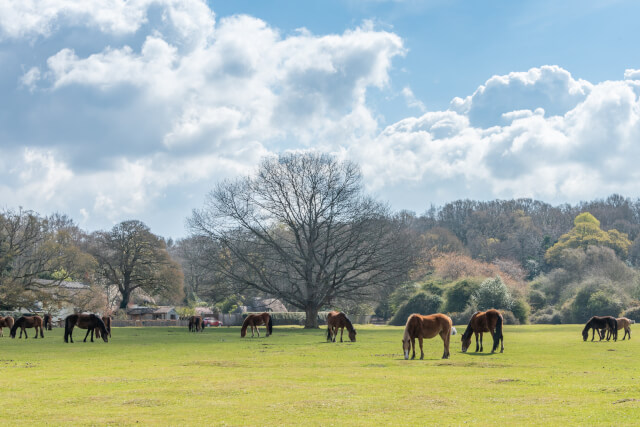
Ashurst Station is the starting point. From here, follow the signs toward the village and join an enclosed footpath. This trail follows the tracks for 200 metres and enjoys views of grazing ponies in a neighbouring field. Turn right, and pass through a car park and road junction until you reach The Happy Cheese pub.
From here, turn left and through a wooden gate; this part of the trail enjoys views of the Ashurst cricket pitch. You’ll soon reach another gate, pass through this and follow the track to a junction. Head right, then back into the open forest and follow a track over a railway bridge to Ashurst Wood.
After passing through the woodland pasture, you’ll reach Ashurst Lodge’s road; from here wander right to the end of the woodland to Longwater Lawn. You’ll be able to see the ruins of a saltpetre house before passing by a cattle grid and crossing the A35.
Follow the road for 600 metres before crossing again and continue for 50 metres to the railway station.
Distance: 2.8 miles
Difficulty: Easy
Suitable for: Families and pets
Starting Point Coordinates: 50.8897933, -1.5288492
Find the full route here.

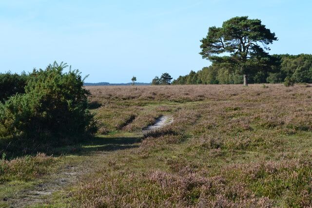
A scenic trail, Lyndhurst Heath Circular Walk is a lovely hike to add to this array of walking routes in the New Forest.
The route begins east of Lyndhurst and takes you across the cattle grid onto Beaulieu Road. From here you’ll enter the national park and will need to follow the path past the cemetery and village cricket grounds.
The track continues across the heathland, where you can enjoy wonderful views of the countryside and the ponies. The path will soon descend and take you across the road towards Pondhead Farm. The track will split here, take the right path.
This part of the hike winds through open woodland and certainly feels enchanting! Soon you’ll join a wider track where you’ll need to turn right and head through a gate before entering Lyndhurst from the south.
Why not treat yourself to a post-walk snack in one of the village’s pubs or tea shops?
Distance: 3.6 miles
Difficulty: Easy/moderate
Suitable for: Families and pets
Starting Point Coordinates: 50.8726263, -1.5729631
Find the full route here.
Another New Forest Walk that isn’t short on views, this loop trail offers uninterrupted vistas of the Isle of Wight hills. You can usually complete a walk around the heath in two miles, but this walk stretches to 5.7, taking you by the Roundhill Campsite.
Starting at the Beaulieu Heath Inclosure car park, follow a way-marked path around the former airfield. After reaching the westernmost area of the trail, follow a track to the heathland’s border and cross several bridleways. You’ll soon find Roundhill Campsite on your right before turning onto Thistle Lane.
Pass by a farm before turning right into a patch of woodland. Continue to follow the path through the woodland until you rejoin Thistle Lane. Cross the lane and pass by another farm before heading back into the heath and towards the car park.
Distance: 5.7 miles
Difficulty: Moderate
Suitable for: Adults
Starting Point Coordinates: 50.8023597, -1.4959984
Find the full route here.
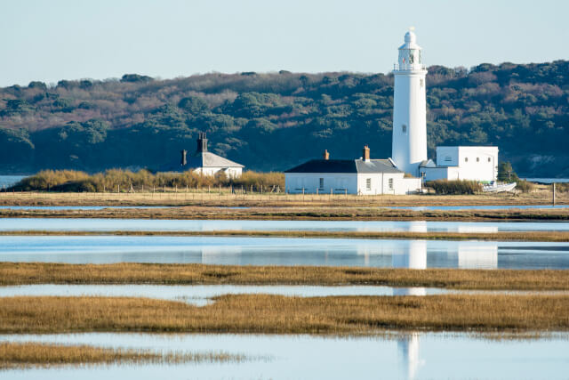
When it comes to New Forest walks by the water, the Keyhaven Marshes Walk is a superb choice! Featuring a section of the Solent Way, you can enjoy sights of the Isle of Wight and the Needles during this hike.
Starting at the Keyhaven green bus stop, head towards the coast and take the first left past The Gun Inn. Continue past the harbour wall and over Avon Water’s mouth. Turn right at a marker and follow a gravel path atop the sea wall.
At this point you’ll be walking along the Solent Way; please be mindful of wildlife here. A shipwreck, the Fishtail Lagoon and a bird nesting island are just a few of the intriguing sights here. Follow the path’s left turn to the jetty before turning left again and walking on a wide track.
Take the upper path when the track divides and you’ll get to see the lovely grassland of a local reserve. Afterwards, pass through the historic highway by the Efford Landfill Site before retracing your steps back to the start.
Distance: 3-4 miles
Difficulty: Easy/moderate
Suitable for: Families
Starting Point Coordinates: 50.7240994, -1.5792211
Find the full route here.
The last trail in this collection of walks in the New Forest weaves through the forest community of Hale and the village of Woodgreen.
Start at the Pineview bus stop, and head towards Redlynch Sports and Social Club. Keep following the track towards the national park’s boundary marker, ignoring any turns. Turn left at the marker and cross a meadow where you’ll see a pond packed with wildlife!
Follow the path into the wood before turning onto Hale Lane and heading towards Home Farm. Turn left at the farm, then right towards St Mary’s Church. Continue past the church and join Moot Lane, then turn right, follow a field’s edge and cross three stiles.
Soon you’ll be at the Woodgreen Village, why not take a detour? Alternatively, spot the ponies on Woodgreen Common before travelling through the village and heading towards the Stricklands Plantation. After this, you can enjoy the sights of Hale Park and Hatchet Lodge before entering Hatchet Green.
Spend some time in the meadow before wandering into a close-by woodland and heading back to Woodfalls.
Distance: 5.7 miles
Difficulty: Moderate
Suitable for: Adults
Starting Point Coordinates: 50.9774873, -1.7193487
Find the full route here.
Want to try out these New Forest walks? Be sure to enjoy them from a lovely base, such as a New Forest cottage or a Hampshire holiday cottage. Alternatively, uncover even more walks in the UK and Ireland by reading our Walking Holidays guide.
Image Credits: Clive Perrin – CC BY-SA 2.0; David Martin – CC BY-SA 2.0

Hi, I'm Lola and I joined Sykes in 2021. My favourite holiday destination in the UK has to be Suffolk, I have so many happy memori...
Read More About AuthorSign up to receive exclusive offers, competitions and the latest news to your inbox, and you'll be entered into our monthly prize-draw 3 times!

Unearth Britain’s ancient past and learn how to find your very own relics with this comprehensive UK fossil hunting...

Bordering the Irish Sea and spanning three counties, these beaches in the North West make for excellent places to...

If you are looking to explore the UK’s stunning coastline and want to know what you can find hidden...
Are you on the phone to our call centre? Your Customer ID is:

Get involved in the Discussion